
As you may(or may not) have heard there is a wildfire currently burning south of Prescott.
On April 18, 2022 the Crooks Fire began about 10 miles south of Prescott. The cause has not been determined as of this blog post and is still under investigation.
The fire is around 6400 acres with under 25% containment at this time due to dead/dry vegetation and erratic and gusting winds the Prescott area has been experiencing.
You can follow this link to the Forest Service website for a full list of what’s closed. https://www.fs.usda.gov/detail/prescott/recreation/?cid=FSEPRD582472 There’s also an area map of the closure zone on that same page.
Just to name a few closures: Prescott Circle Trail from White Spar to Sun Dog Trail, all trails in Lynx Lake [This includes Lynx Ruins, the campground and both shores of Lynx Lake, as well as the Highlands Center for Natural History], Groom Creek(schoolhouse, nature trails, Horse Camp), Palace Station, Upper & Lower Wolf Creek Campground, Schoolhouse Gulch areas, White Spar Campground, along with any designated camping along Senator Highway.
Here are a few more web known closures that Prescott visitors should be aware of:
Watson Lake Park – (closed until further notice by the city of Prescott)
The Watson Lake viewpoint pull off on 89 is also closed.
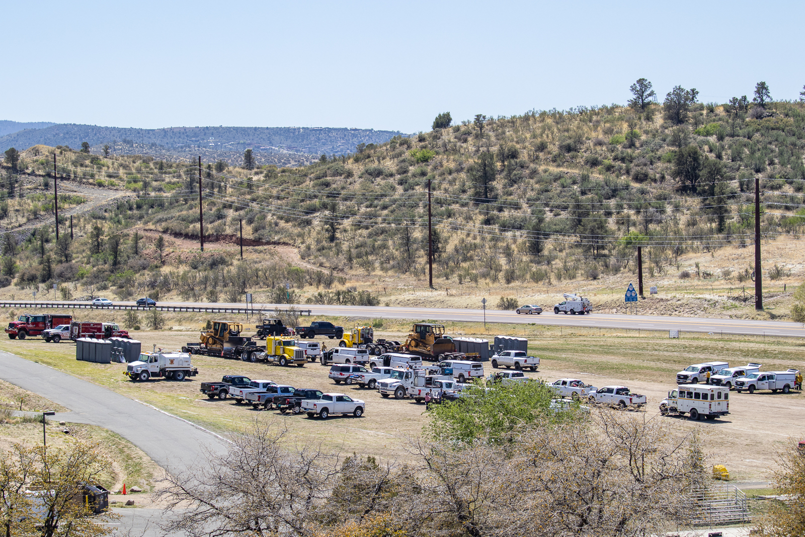
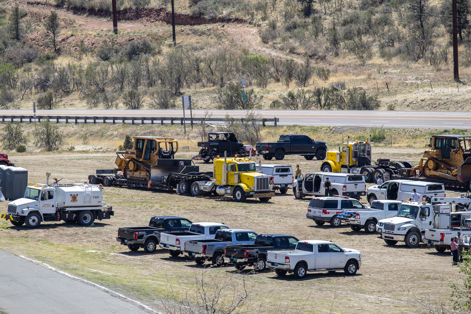
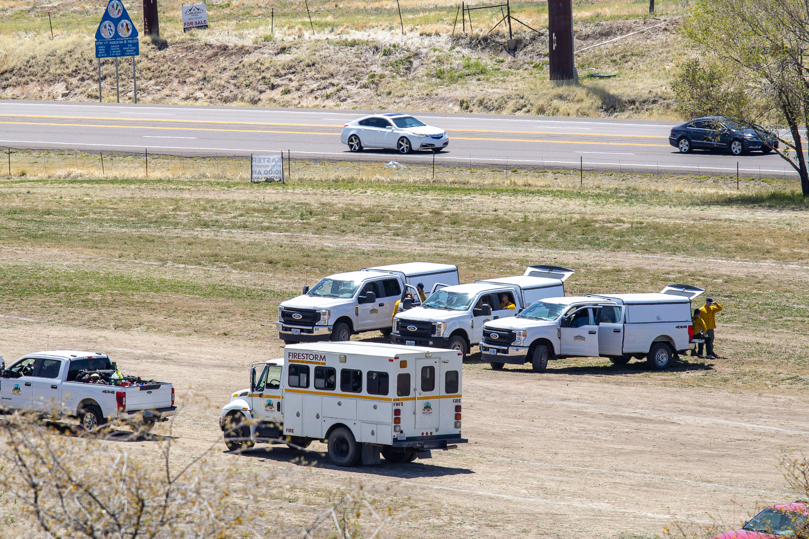
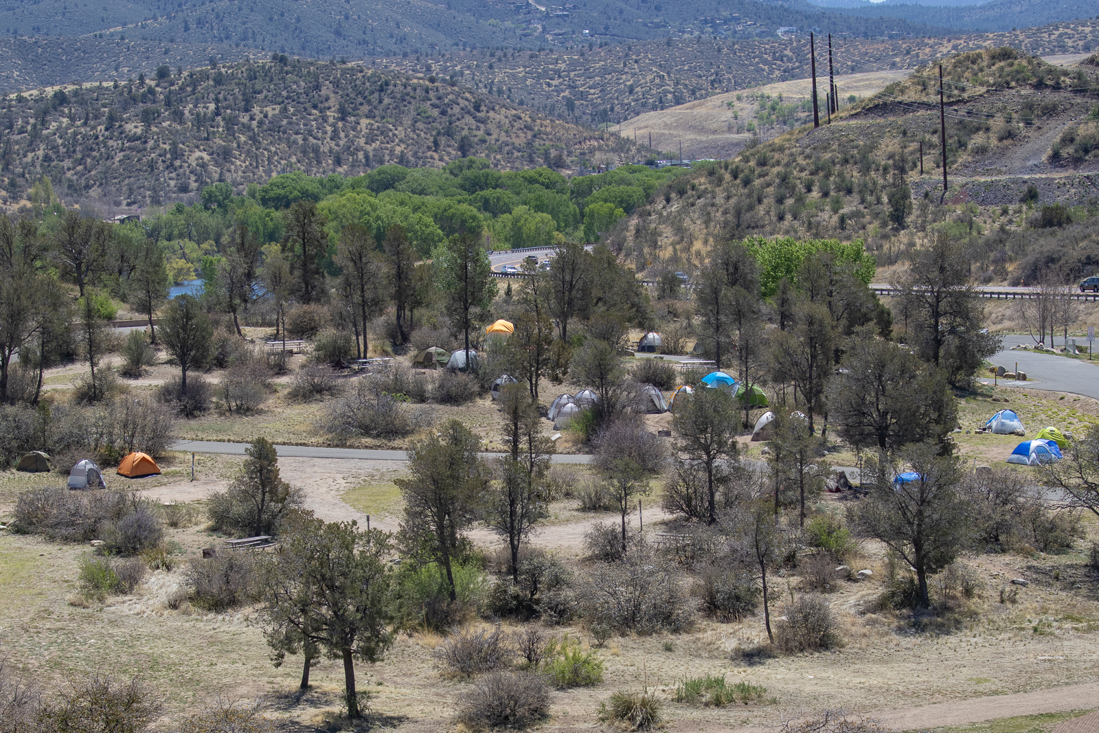
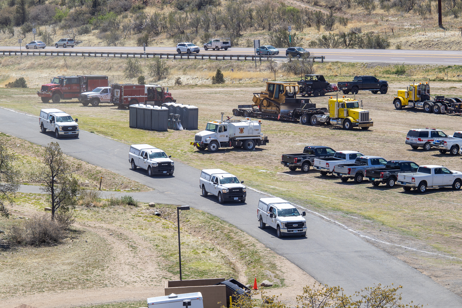
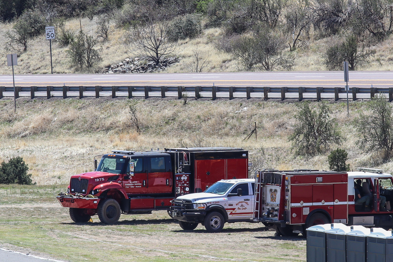
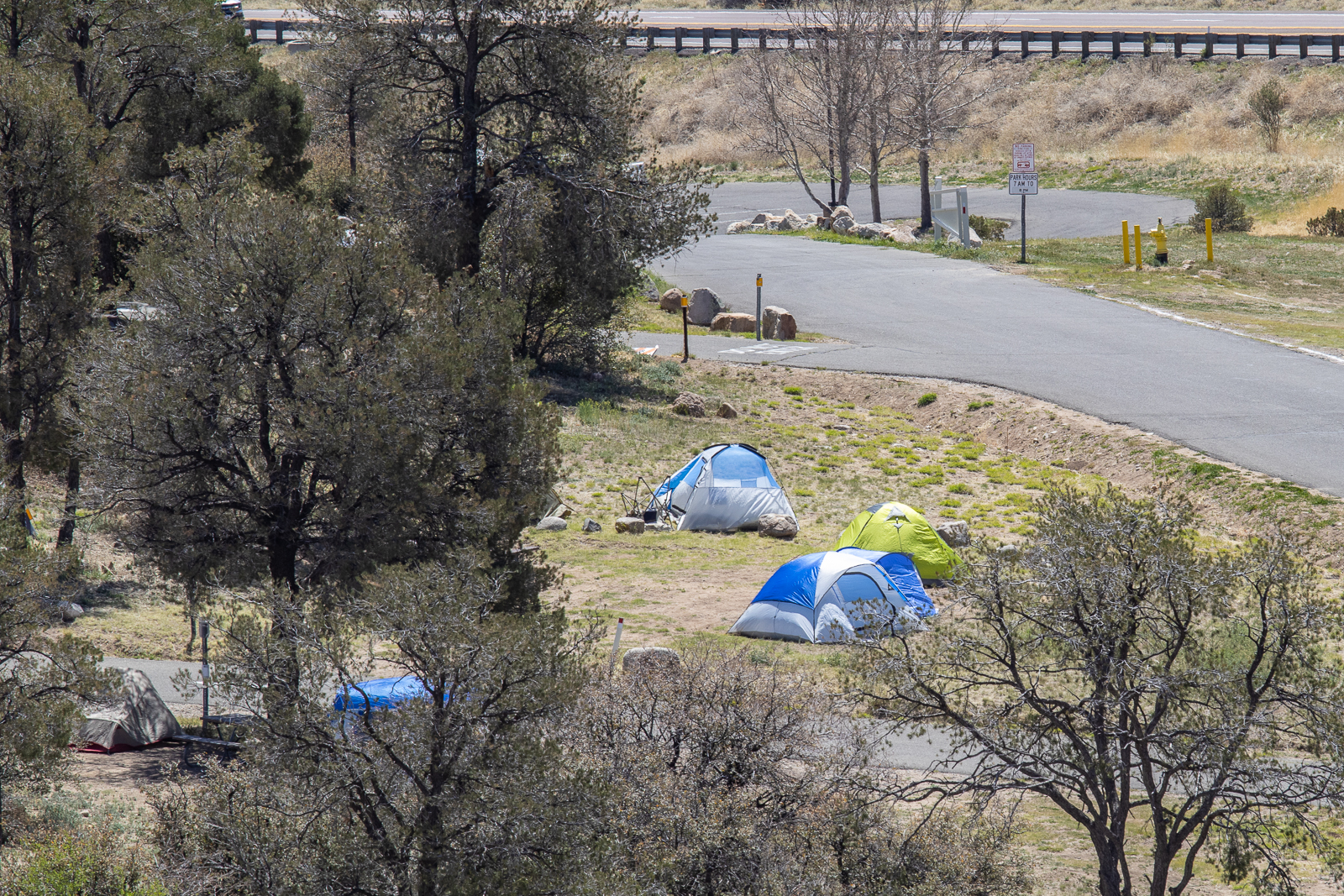
Though it’s not directly impacted by the Crooks Fire, it is being used for staging of first responder vehicles; from land clearing trucks on flatbeds to forest vehicles. Many of the fire fighters and crews have tents set up there as well.


The trails as well as access to Watson Lake are closed to the public until further notice. The Peavine trail is still accessible from outside of the park though there may be signage or caution tape preventing you from using the Peavine the inside Watson proper.
I took a climb up some rocks adjacent to (but not inside of) the park to see what exactly was going on and to satisfy my curiosity as to why even the trails were closed. It didn’t take long for me to understand. The continued and constant movement of emergency vehicles in, out, and through the park, made me realize that allowing even foot traffic would be a hindrance to the crews and their vehicles.
Goldwater Lake – (closed until May 3, 2022 or until the restrictions are rescinded, whichever occurs first. As per Prescott National Forest Bradshaw Ranger District)
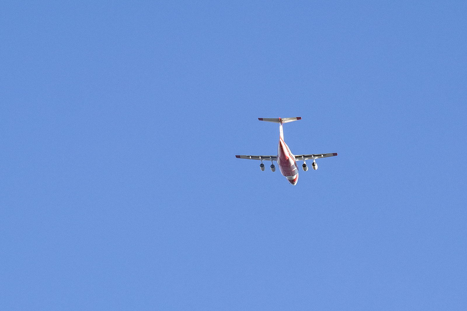
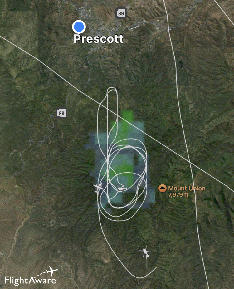
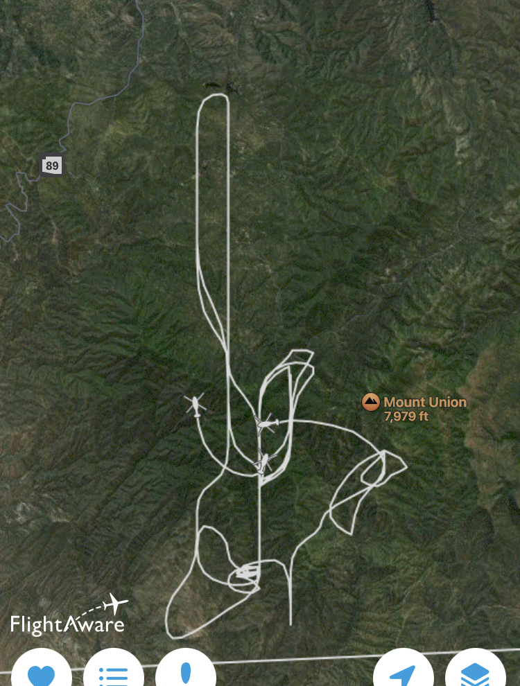
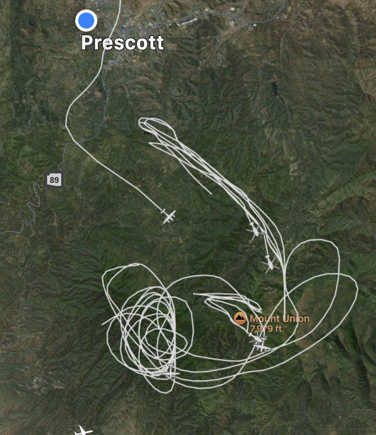
As you can see on the accompanying image, several helicopters are utilizing Goldwater Lake to fill up and get right back to dropping on the fire. Senator Highway is closed past a certain. Unfortunately if you were wanting to visit the silver mine, sorry the road is closed. And so are the dispersed designated camping sites along Senator.
Don’t even try to get near it to see the helicopters filing up…because you can’t. The images are from an app called FlightAware. It’s a simple app that shows you any aircraft in the sky. With the screenshots I’ve done you can see the aircraft’s flight path as well as the smoke creating its own cloud. Those images were 1 day apart from each other


Lynx Lake Recreation Area – (closed until May 3, 2022 or until the restrictions are rescinded, whichever occurs first. As per Prescott National Forest Bradshaw Ranger District)
The fire is burning too close to the area so all trails at/near/around Lynx Lake are closed. There is a checkpoint set up for any of the residents from the Walker Road area.
Remaining open and out of harms way are Willow Lake, Thumb Butte, Granite Basin, Horsethief Basin, and Alto Pit OHV Area. There’s only one temporary trail closure on Thumb Butte(John Tank’s Trail) for bald eagle nesting.
Recreational sites on Mingus Mountain are set to reopen on May 1st.